Subsurface data management connected to ArcGIS
Geotechnical teams need the context of the built environment to plan and shape their ground models. Stakeholders and decision makers need to have the most accurate and up to date ground information for their plan-build-operate cycles. GeoDin–Esri collaboration connects the world above to the subsurface, so the context of your project shapes your site investigation and the resulting ground models flow straight into the maps where site decisions are made.
Why connect GeoDin and Esri ArcGIS?

One source of truth
Ensure your site investigation is planned with existing information and infrastructure data from ArcGIS. Manage boreholes, CPTs, and lab data in GeoDin, then publish them to ArcGIS as authoritative point features, geometry, attributes, and attachments intact.

Self-serve access for every role
Civil designers, GIS analysts, project managers, and owners pull current ground conditions on demand through feature services, ArcGIS Online web maps, and 3D web scenes.

True BIM GIS integration
GeoDin sits at the meeting point of BIM, CAD, and GIS, so subsurface information moves cleanly between Autodesk Civil 3D, ArcGIS Pro, and the cloud.

A foundation for a ground digital twin
Layer boundaries, borehole cylinders, and soil models combine with terrain and imagery in ArcGIS to build a true digital twin of what lies beneath your site.
How the GeoDin–Esri workflow works
The integration follows the full geotechnical workflow from investigation planning, capture and ingest, manage and process, design and visualize, and collaborate and decide, having GeoDin as the data backbone at every stage.
Plan investigations on the map
Before drilling starts, geotechnical engineers plan investigations in ArcGIS using historic boreholes, soils and geology layers, groundwater data, and imagery from ArcGIS Living Atlas. Better upfront knowledge of the geospatial context and subsurface means fewer surprises in the field and a tighter, lower-risk, optimized ground investigation program.
Capture and ingest field data
Field crews collect borehole and CPT data and bring it straight into GeoDin. Legacy logs, e.g. from ArcGIS, can be ingested into GeoDin such that all subsurface data is centralized rather than stranded and siloed in different locations.
Manage and process in GeoDin
GeoDin is where the data becomes insightful: validated, structured, and ready to report. Generate consistent, compliant borehole and CPT logs from 200+ built-in templates, and export to ArcGIS Pro as fully attributed point features with coordinate integrity preserved end to end.
Move borehole data both ways with ArcGIS Pro
The integration runs in both directions. Import borehole locations from an ArcGIS Pro point feature class into GeoDin, or export GeoDin boreholes into ArcGIS Pro ready for spatial analysis. You can even attach finished GeoDin reports directly to borehole points, so clicking a location on the map opens the full log, no folder hunting.
Design and visualize in 3D
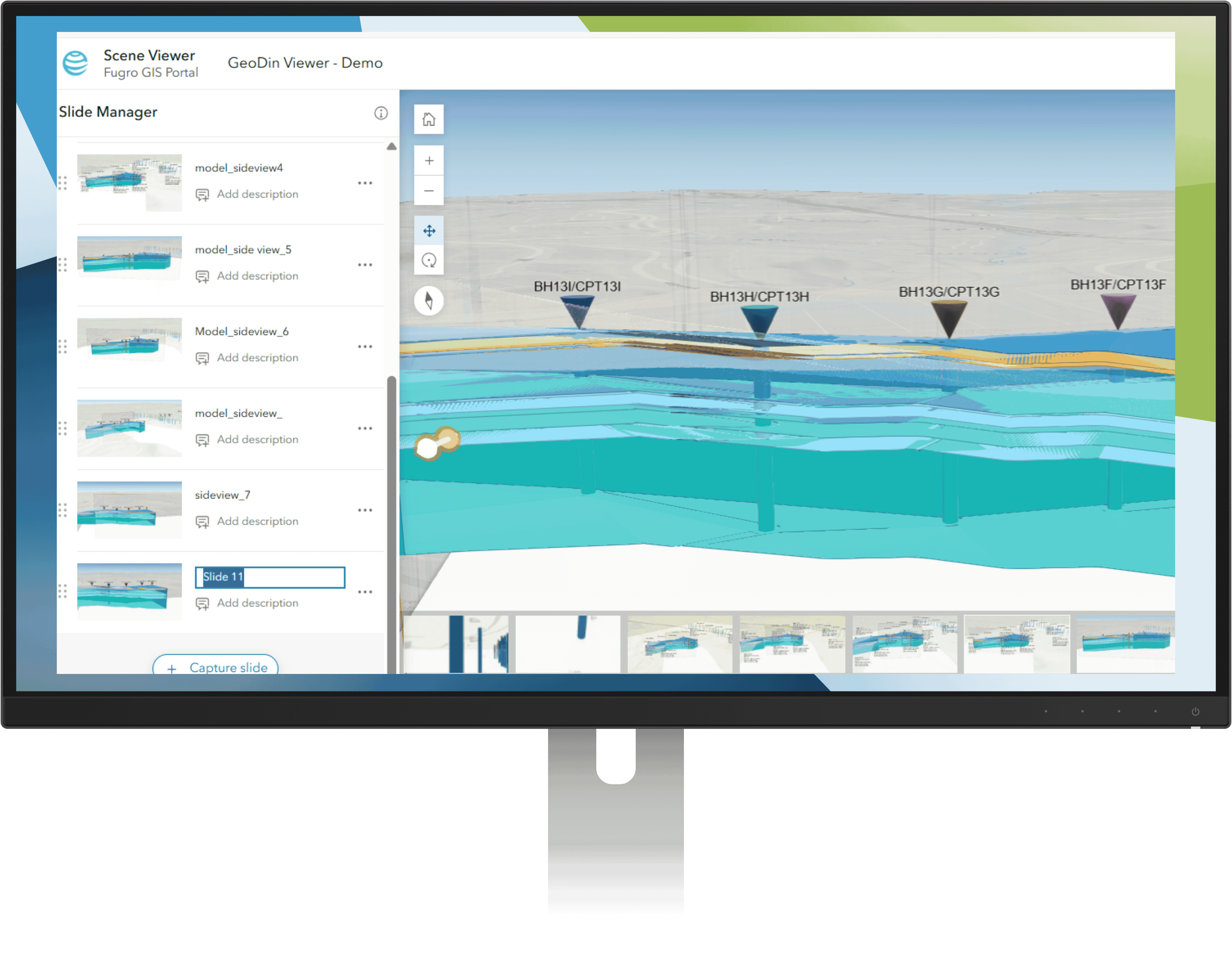
In ArcGIS Pro, boreholes become 3D solids (multipatch), soil layers become surfaces, and the subsurface comes to life alongside terrain and the built environment, empowering insights and contextual decisions to be made.
Collaborate and decide
Publish the model to ArcGIS Online as a web scene, and owners and project managers review real subsurface conditions in a browser tab, no specialist software required. Decisions on planning, modifications and timelines get made on contextual, shared, trustworthy data.
GeoDin and Esri across BIM, CAD, and GIS
GeoDin connects to the wider design ecosystem through the strategic alliance between Esri and Autodesk. With GeoDin Ground running inside Autodesk Civil 3D, geotechnical engineers create borehole locations as COGO points, boreholes as 3D solids, and layer boundaries as TIN surfaces, then share that content to ArcGIS using ArcGIS for AutoCAD.
For the civil designer, this means existing ground conditions arrive on demand inside the tools they already use. For the GIS analyst, it means geotechnical information content lands in ArcGIS as standard, queryable features. And for the project, it means three-way interconnectivity with planning and geospatial context in ArcGIS, with ground truth in GeoDin and design in Autodesk, coming together for safe and sustainable infrastructures to be built.

Frequently Asked Questions
If you don’t see your question here, we’re always available to help.
Get in touch to discuss your needs, explore opportunities, or clarify how we work.
BUILD ON SOLID GROUND™
Today with GeoDin®
Your cart
Taxes will be calculated at checkout