Subsurface modeling software that works inside Civil 3D
GeoDin Ground is a subsurface modeling plugin for Civil 3D, developed by GeoDin and Autodesk. It brings boreholes, soil layers, CPT data, and geotechnical test results into your design model, so you can build 3D surfaces and volumes from them. Use it free with a GeoDin database or add a subscription to import and interpret your own AGS files.

Ground data should not arrive as a 200-page PDF
Most design teams still receive the ground as a report. Someone reads it, retypes the layers into a spreadsheet, and builds surfaces by hand. By the time the subsurface model is ready, the investigation data may have changed.
GeoDin Ground replaces that handoff. Geotechnical data comes into Civil 3D as structured, georeferenced objects. Designers see what they are building on, and geotechnical engineers see their work used the way they meant it.
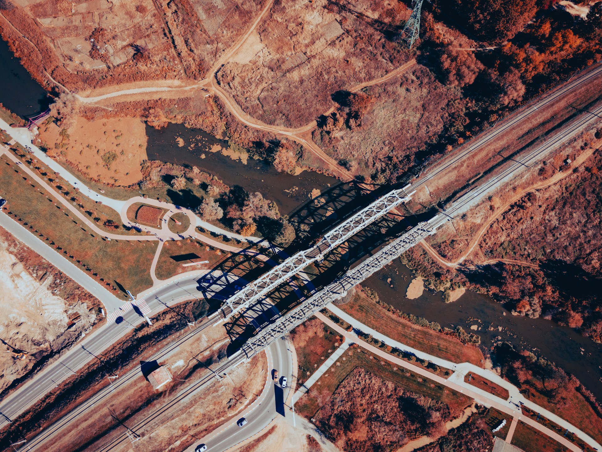
Subsurface modeling software and 3D geological modeling software: where GeoDin Ground fits
There’s a clear distinction between the types of software tools for subsurface modeling:
- Geotechnical data management software that stores and checks site investigation data.
- 3D geological modeling software, such as Bentley Leapfrog, which builds detailed geological interpretations.
- Apps for the design environment that put the subsurface model where the design happens.
GeoDin Ground is the third kind. It builds a 3D geological model of the strata inside Civil 3D, next to your alignments, corridors, and surfaces, from data in a GeoDin database or from AGS files. If your team used Autodesk's Geotechnical Modeler (also known as the Geotechnical Module), GeoDin Ground is the next generation replacement.
How does GeoDin Ground benefit civil engineers?

Enhance design accuracy
GeoDin Ground empowers you to see beneath the surface directly within Civil 3D. By integrating comprehensive ground data, you can create truly optimized designs, perfectly tailored to the specific conditions of your site, eliminating guesswork and ensuring a solid foundation from the start.

Increase efficiency and savings
GeoDin Ground centralizes all geotechnical data (boreholes, lab results, etc.) in one hub, integrating seamlessly into design workflows to reduce data management time and cut project costs.

Improve collaboration
GeoDin Ground enhances team communication by providing a clear, shared view of subsurface conditions within Civil 3D. This improved understanding fosters better collaboration between design and geotechnical teams, allowing for proactive identification and mitigation
Visualize your ground data in detail
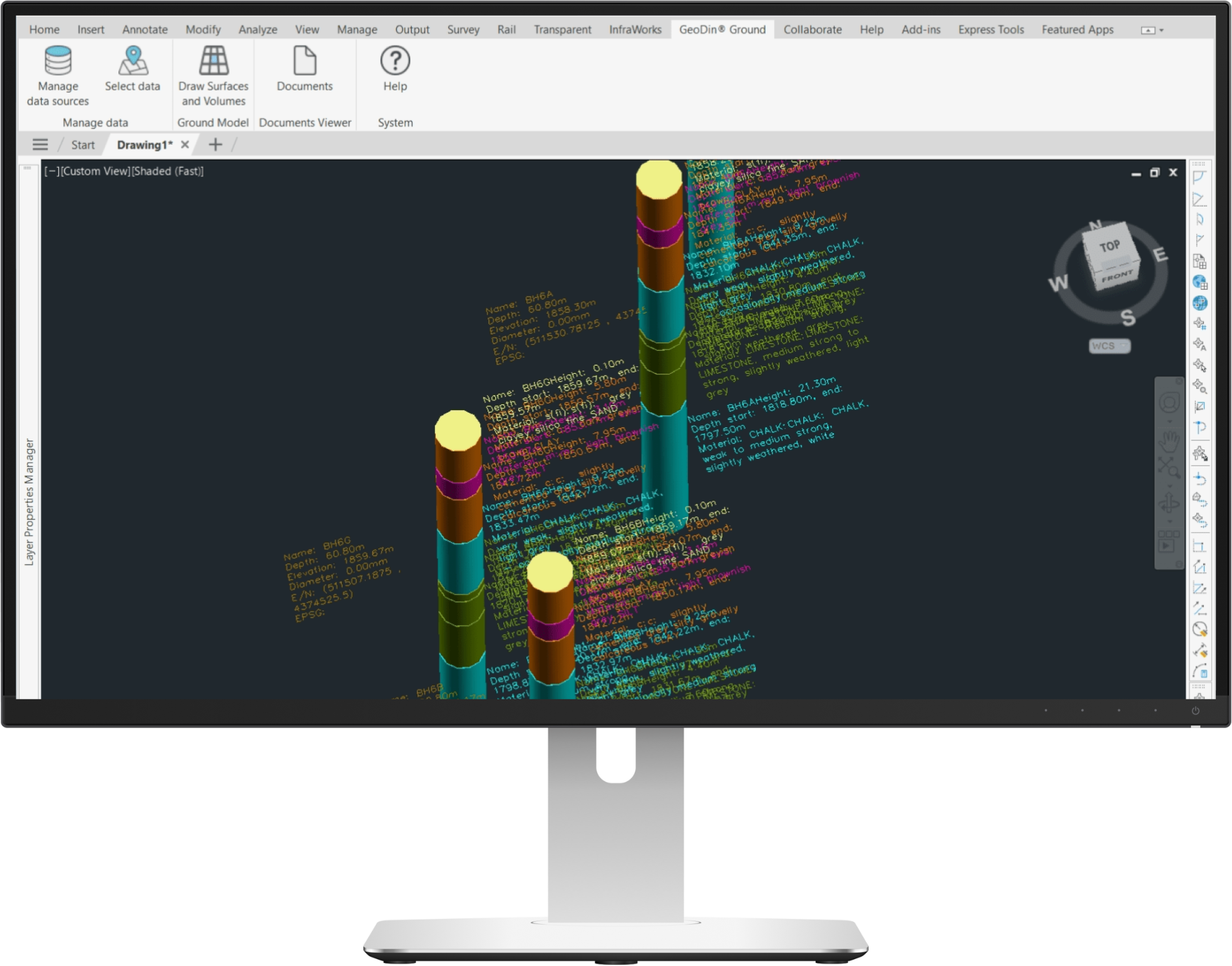
Boreholes directly visible in Civil 3D
Visualize your boreholes directly in Civil 3D. Clay, sand, dirt? With color coded lithological layer descriptions, it's easier to understand what the sampled boreholes are made of.
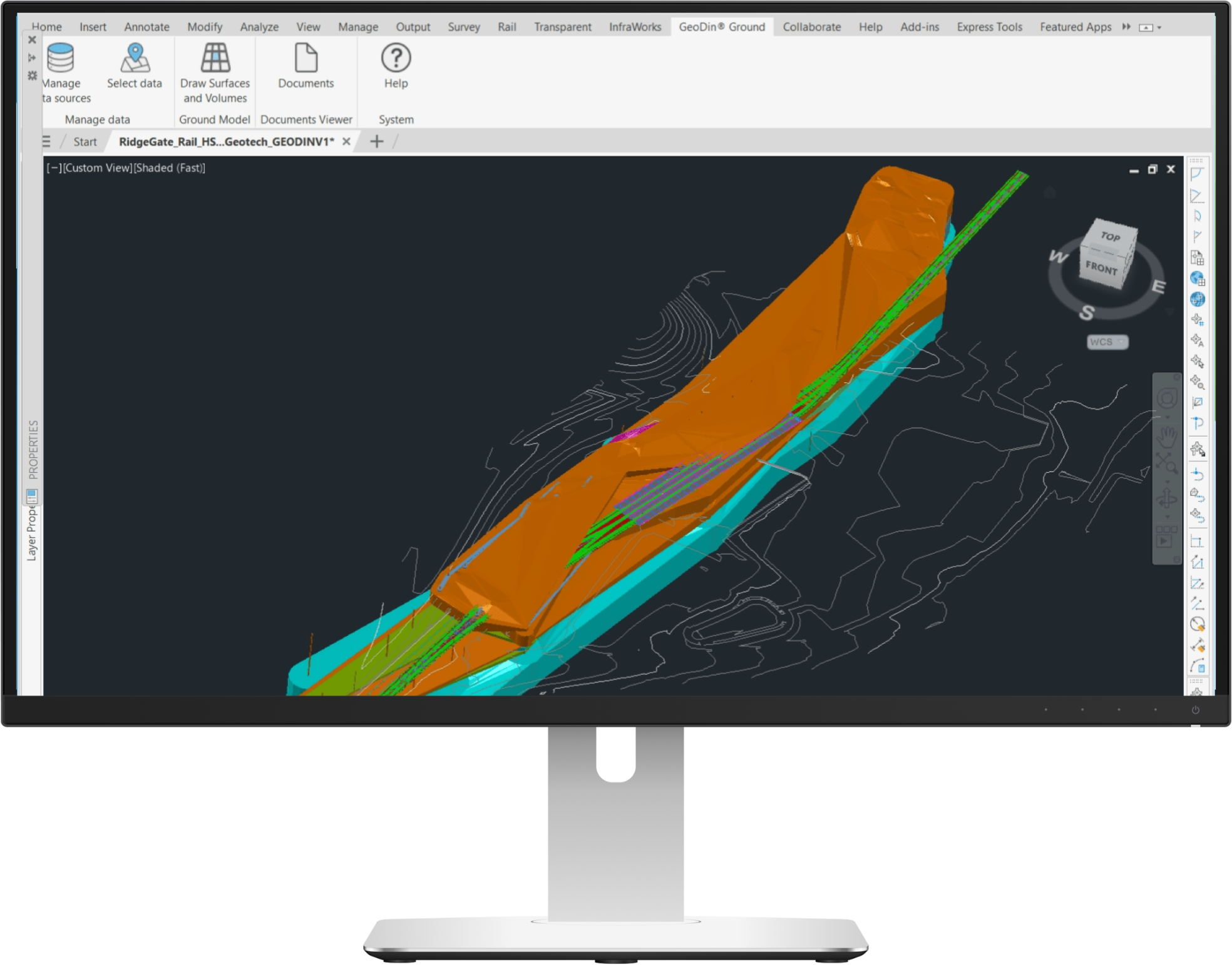
Adjustable surfaces and volumes
Go beyond simple borehole sticks to generate powerful 3D strata surfaces that represent geological layers. GeoDin Ground makes it easy to create and manage these surfaces directly within Civil 3D. You can toggle the visibility of specific strata to analyze interactions, calculate exact volumes for excavation or material estimation, and generate dynamic cross-sections and profiles along any alignment, providing a clear view of the subsurface for your design.
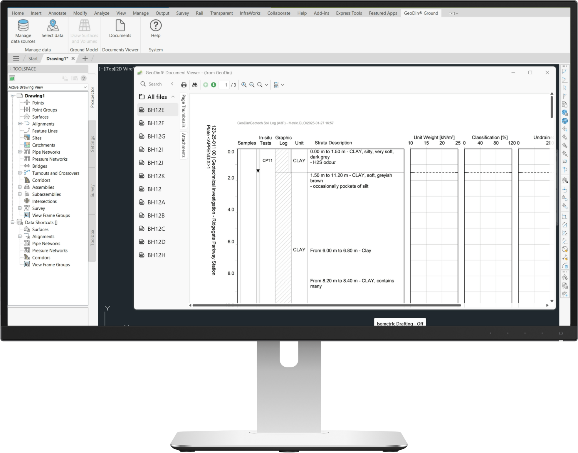
Relevant documents attached to boreholes
Do you have to visualize the technical representation of your borehole? GeoDin Ground has an integrated document viewer that helps you pull up the technical documentation to better understand your ground data.

Virtual logs for a better understanding of your model
Want to gain insights without the drill? Our new virtual logs feature allows you to modify and extend your existing ground model. This powerful tool provides on-demand subsurface insights by letting you "pinch" through the model at any location, giving you detailed lithological information and saving you significant time and money on unnecessary drilling.
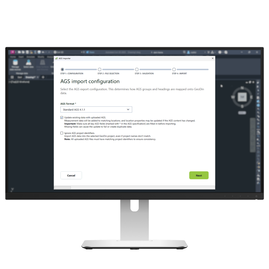
Import AGS files directly into Civil 3D
Many design teams never see a geotechnical database. They get an AGS file from the site investigation contractor and have to make it usable themselves.
With a GeoDin Ground subscription, you load AGS files directly into Civil 3D, without needing a GeoDin database at all. Then use the Layer Interpreter to merge and recode the layers before you build the model. Once your AGS data is in Civil 3D, you work with it the same way as data from a GeoDin database: view the borehole sticks, build strata surfaces, calculate volumes, and add virtual logs.
New to the format? AGS is the data transfer format for site investigation data published by the Association of Geotechnical and Geoenvironmental Specialists. Read more about AGS data management in GeoDin.
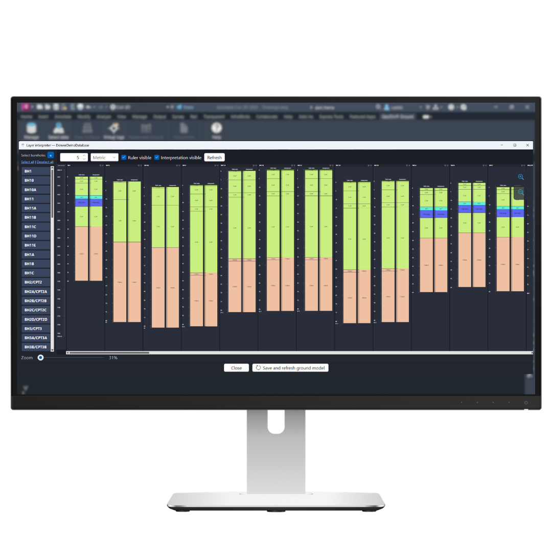
Clean up your layers with the Layer Interpreter
Field logs record every layer the way it was described on site. That belongs in the record, but not always in the model: several separate clay layers become several thin surfaces where your design needs one.
The Layer Interpreter lets you merge similar layers and give them a standard lithology code from the AGS, EN ISO, SEP3, or G1 dictionaries. Your interpretation is saved as a separate dataset, so the original field data is never changed.
When you create the 3D model, choose the interpreted dataset as the source. You get the merged layers and more uniform surfaces to design against.
Two ways to use GeoDin Ground
There is one GeoDin Ground app in the Autodesk App Store. How you use it depends on where your ground data lives.
Your data is in a GeoDin database - free
If your organization, your geotechnical consultant, or a project partner manages site investigation data in GeoDin, GeoDin Ground reads straight from that database. The Civil 3D user needs no GeoDin license. Only the people who curate the database do.
- Boreholes, surfaces, volumes, the document viewer, and virtual logs are included
- It works with a database shared by another company
- The data has been checked and standardized in GeoDin before it reaches your model
- It reads the database directly, so there is no exported file to go stale
What a subscription adds
A subscription is for Civil 3D users who want to build the subsurface model from their own files.
- AGS import: load AGS files from any site investigation contractor straight into Civil 3D
- Layer Interpreter: merge similar layers and assign standard lithology codes for a cleaner 3D model, without changing the original field data
- Nothing new to install: the subscription activates these functions in the app you already have
You can compare the two subscriptions on the pricing page.
Features comparison: Free vs. Paid GeoDin Ground
Who is it for
Anyone with access to a GeoDin database
Civil 3D users without GeoDin & Organizations that use GeoDin
Data source
GeoDin database
AGS files & GeoDin Database
Forma integration
Database manually saved to Forma
Database automatically saved to Forma
Boreholes, surfaces, volumes
Yes
Yes
Document viewer and virtual logs
Yes
Yes
AGS import
No
Yes
Layer Interpreter
No
Yes
GeoDin license needed by the Civil 3D user
No
No
Start standalone, grow into suite
AGS import gets your data into Civil 3D. It only partially checks it, standardize it, or keep it as a project record. Error warnings, standards-compliant borehole logs, parameter plots, and one database for every project are the job of GeoDin. GeoDin Ground then reads from that database, on the infrastructure you choose.
Frequently Asked Questions
If you don’t see your question here, we’re always available to help.
Get in touch to discuss your needs, explore opportunities, or clarify how we work.
BUILD ON SOLID GROUND™
Today with GeoDin®
Your cart
Taxes will be calculated at checkout