Trusted worldwide by geotech engineers for 15,000+ projects at


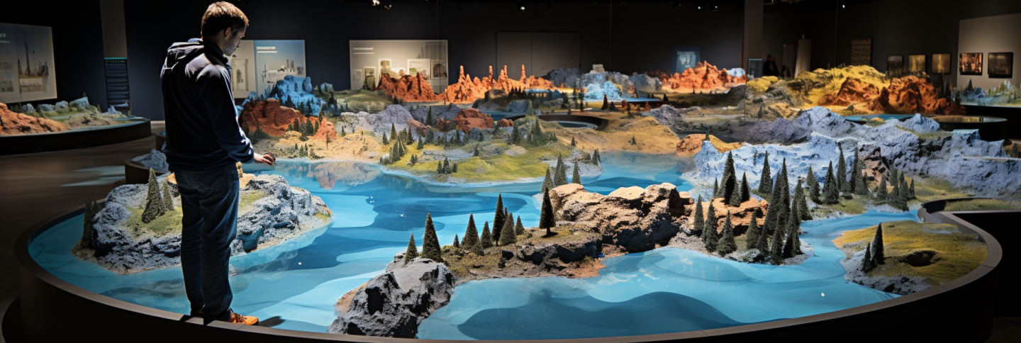
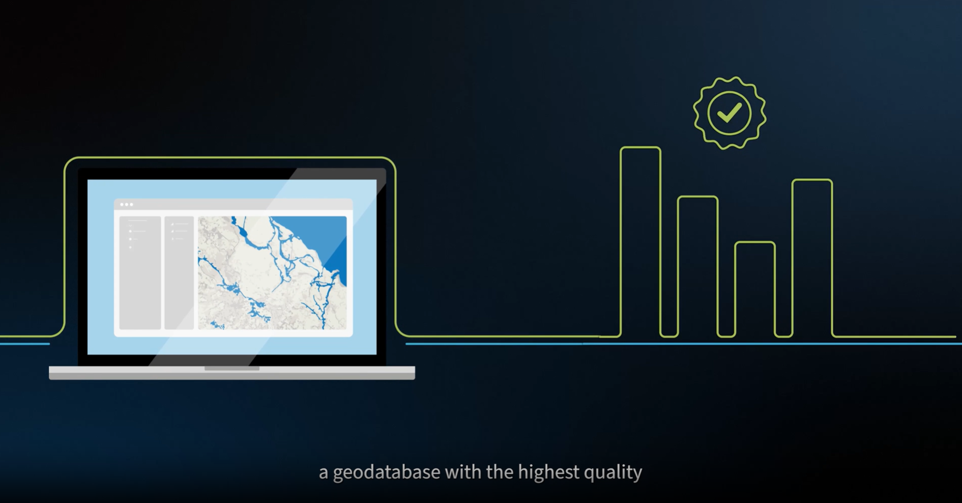
GeoDin supplies cutting-edge geodata management software for geotechnical engineers to create robust geodatabases and visualize what's beneath the ground.
How geotechnical engineers benefit from GeoDin
-

Peace of mind
Building a solid geodata set is hard. Determining the data quality, the cut off point for data collection and eliminating anomalities: GeoDin is here to help you with that.
-

Freed up agenda
Wouldn't it be nice if building that geodata set could be done in less time? GeoDin helps to create a very effective workflow, saving time and resources.
-

Custom models - by you and GeoDin
As an engineer, you always have new ideas for improvements. GeoDin is not a black box. We enable you to customize our models so you can create the very best model.


GeoDin enables a wide range of geotechnical and environmental projects
-
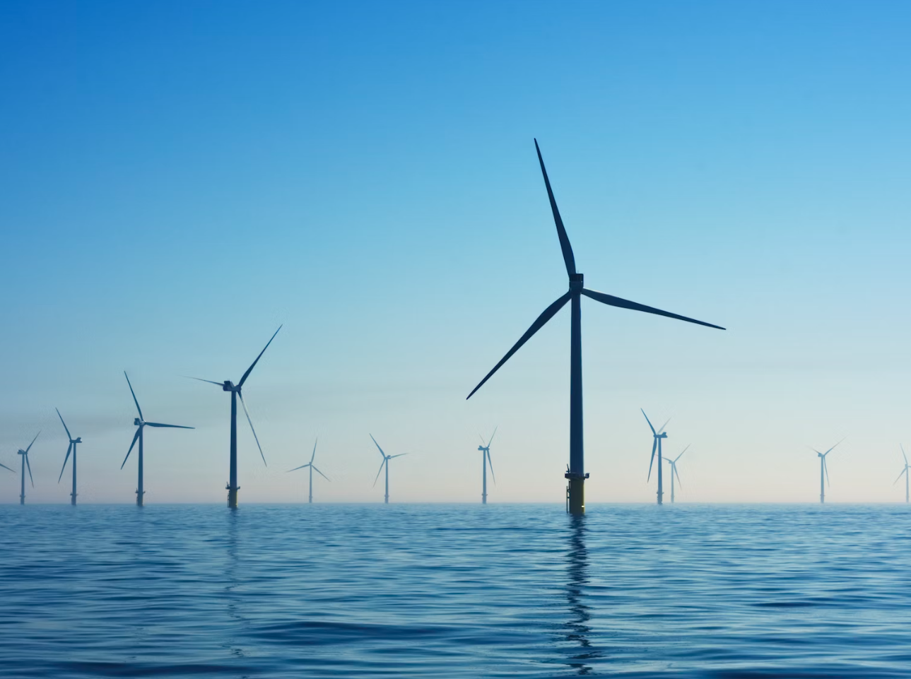
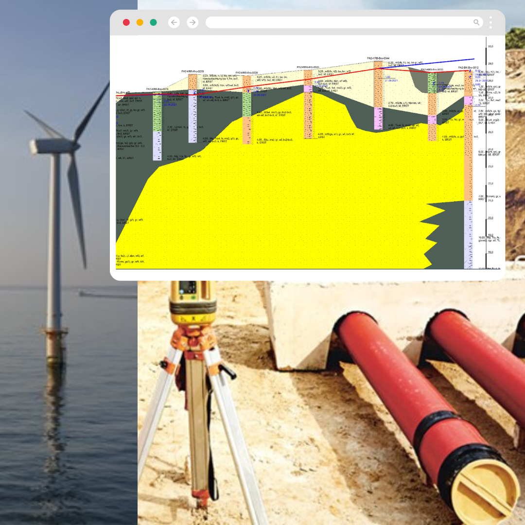
Wind farm geotech investigation
-

Infrastructure geotech investigation
-

Urban information systems
-
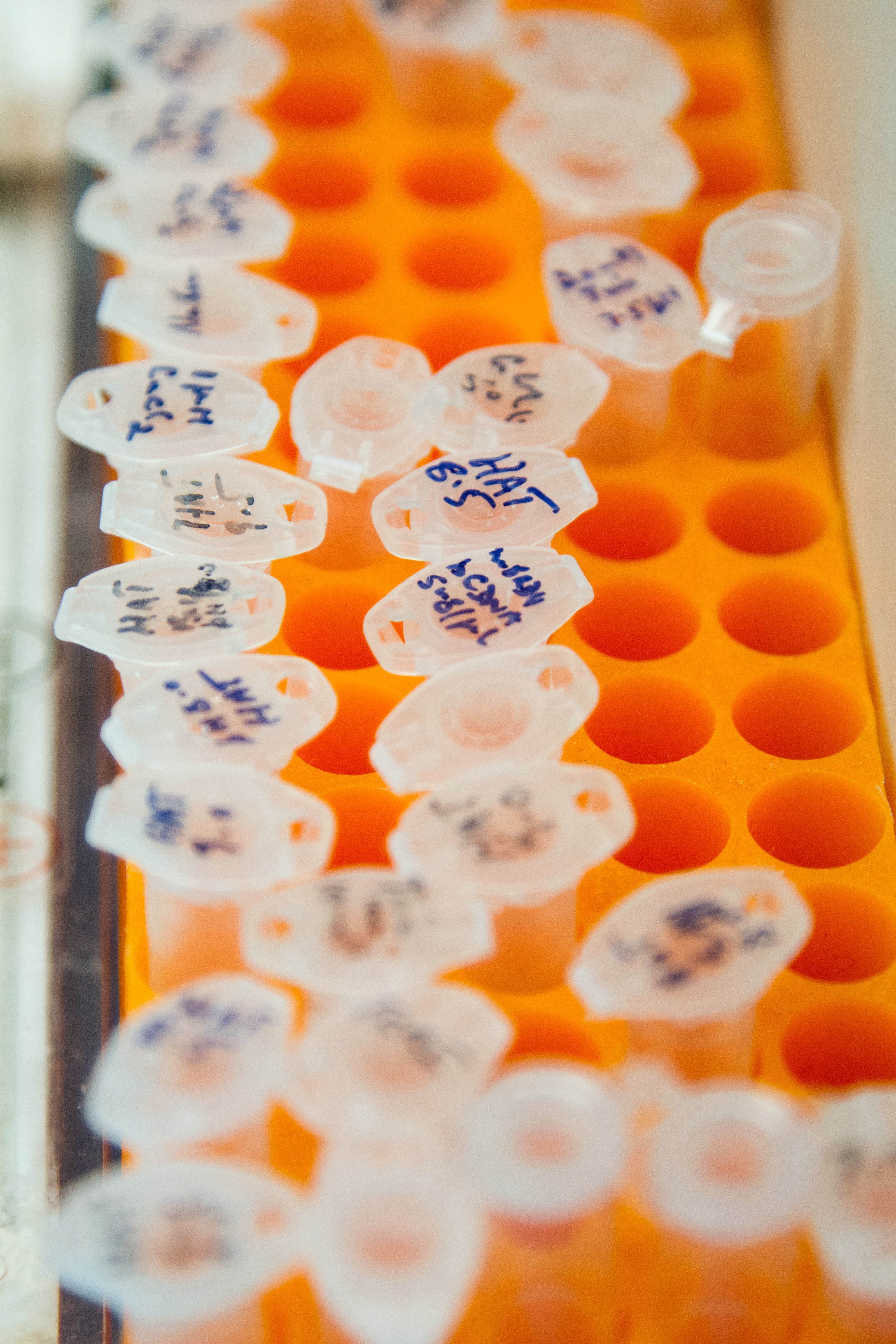
Environmental investigation
-
Water monitoring
-
Land reclamation
-
Tunnel monitoring
-

Landslides solutions


See how GeoDin works: get to insightful reports in 10 steps
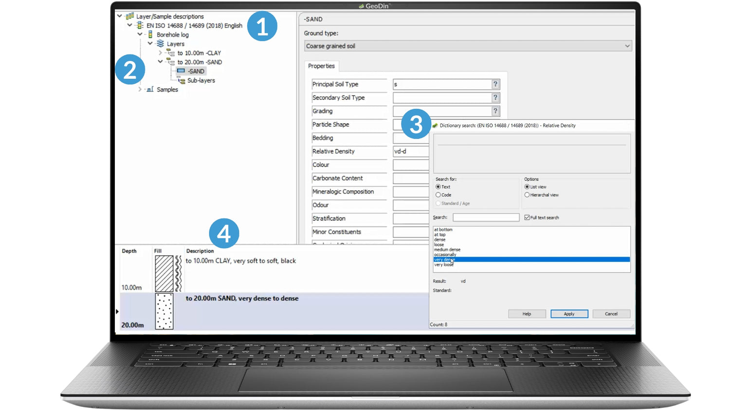
Insert your collected data with trust
1. Choose your Compliance Standard
2. Add subsurface layers and depth
3. Select ground type and properties
4. See the borehole representation
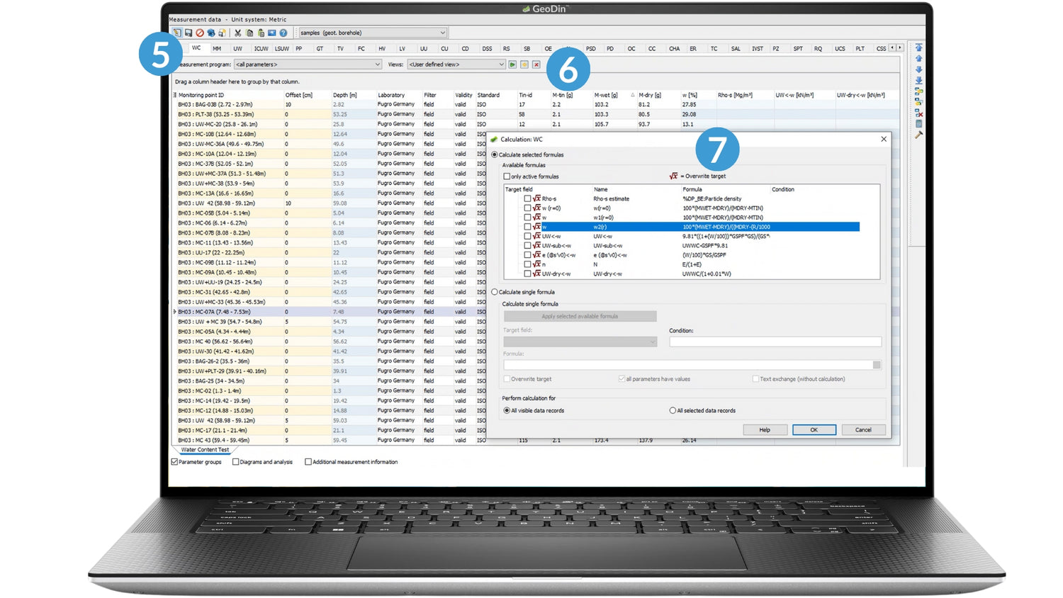
Control your data processing workflow
5. Choose the data-type
(e.g., water content test)
6. Add parameters
7. Get calculated target fields
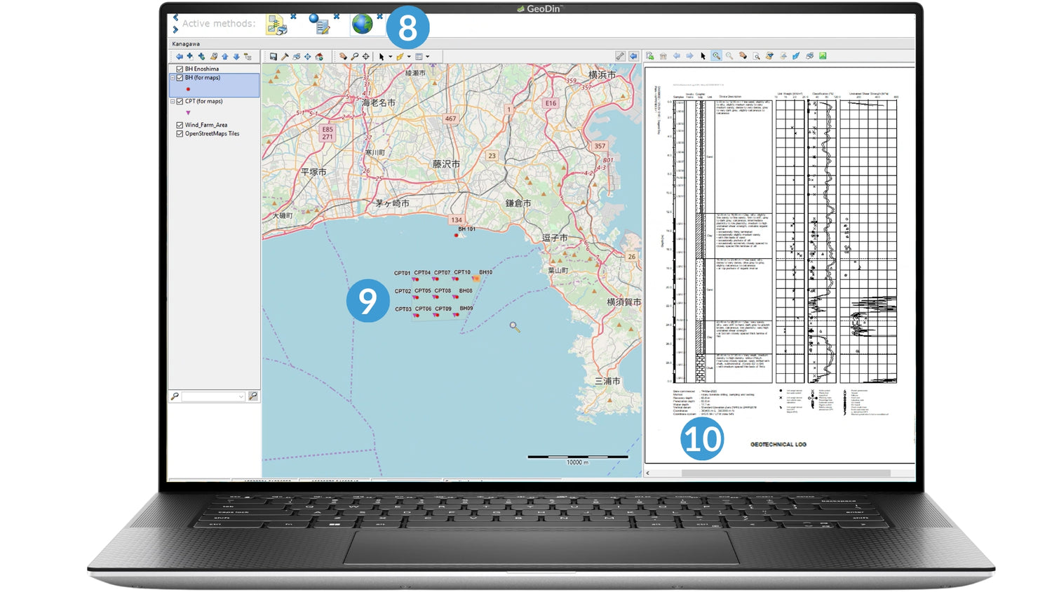
Visualize and present your data & insights
8. Create your map
9. Link objects, queries or groups
10. Customize report templates
(e.g., Geotechnical Log)
Numbers that make us proud
How companies - big and small - use GeoDin for geo projects
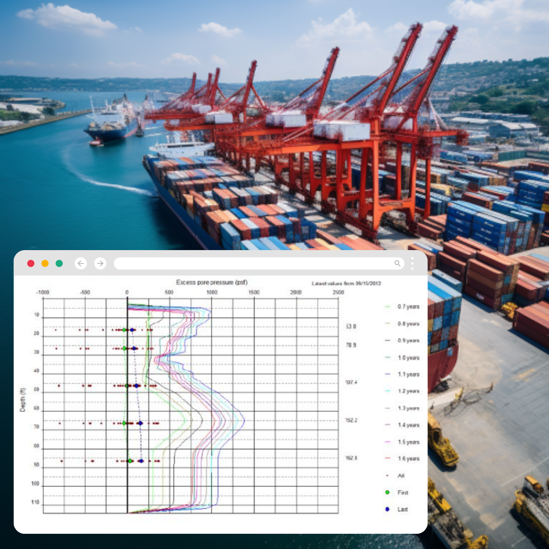
USA | Port of Virginia land reclamation at Craney Island
Largest port expansion in the U.S. using GeoDin
- Database from a wide range of sensors
- Automated import of multiple format sensor files and MATLAB results
- Automated geo-monitoring with instant alert system for data anomalies
- Data types for direct & derived parameters
- Continuous data modeling to predict settlement and guide fill placements
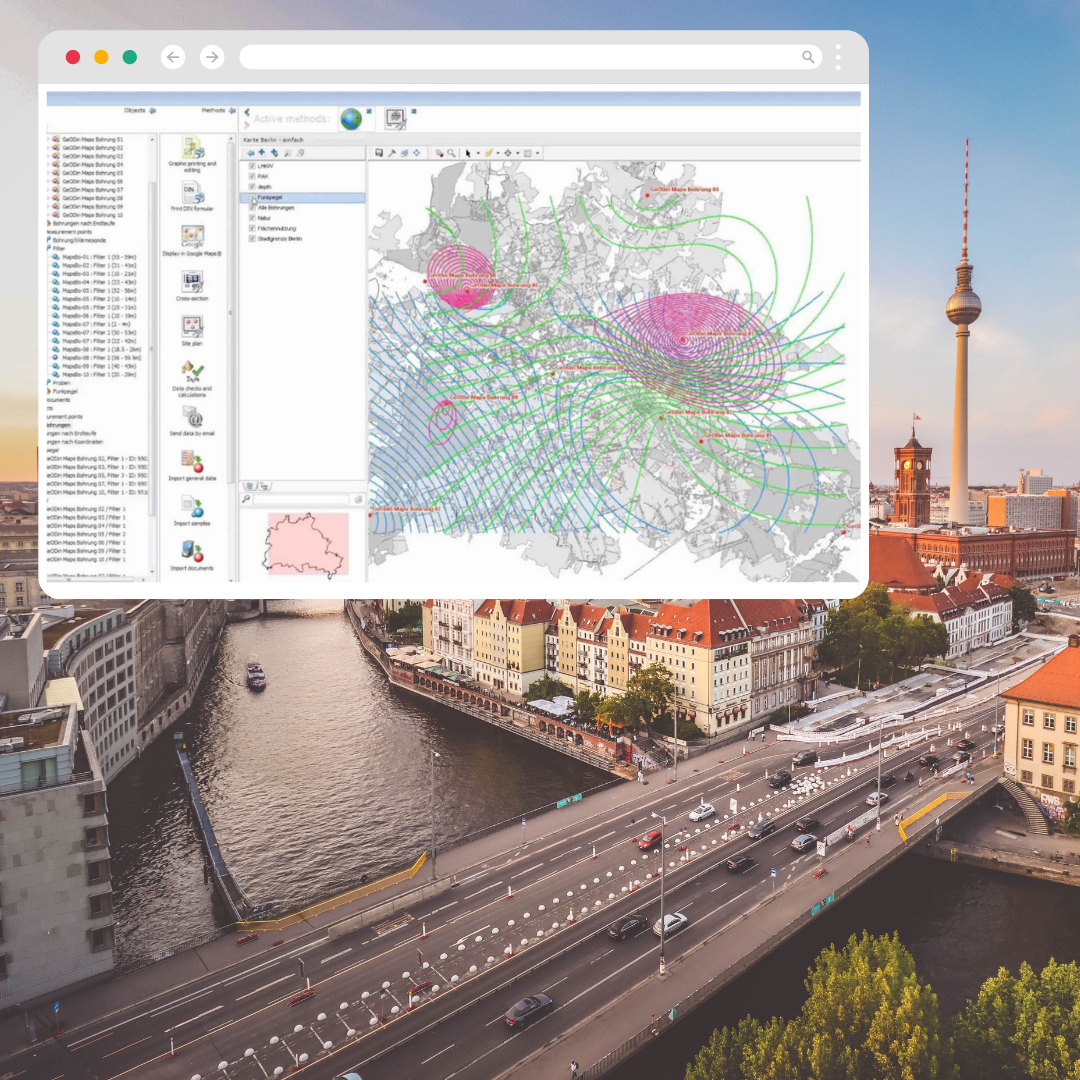
Germany | Berlin Water Management
Water levels managed at all times with GeoDin
- Over 163k boreholes, 12k monitoring wells, and 13 million water samples
- Integrated GIS, offering one-stop solution for analyses and graphics
- Quick & easy search by address, coordinates and measuring point
- Centralized data types: administrative, measuring point, development, (hydro)geological and chemical analyses
- Various interpolation methods for real-time water level insights
*The Senate Department also uses GeoDin for geothermal energy, groundwater flora, geotopes, soil science and monitoring of contaminated sites
Germany | Climate neutrality goals | national power line
Geodata on 700km underline cables' installation managed in GeoDin
- Geodata management for all companies involved in planning session
(e.g. Tennet, Amprion, Transnet BW, 50hertz) - Geotechnical survey, groundwater monitoring and soil assessment data
- Compliance to German public authority standards
- 37 groundwater monitoring wells with cross-section structural model
- Soil assessment data collected in the field via mobile app
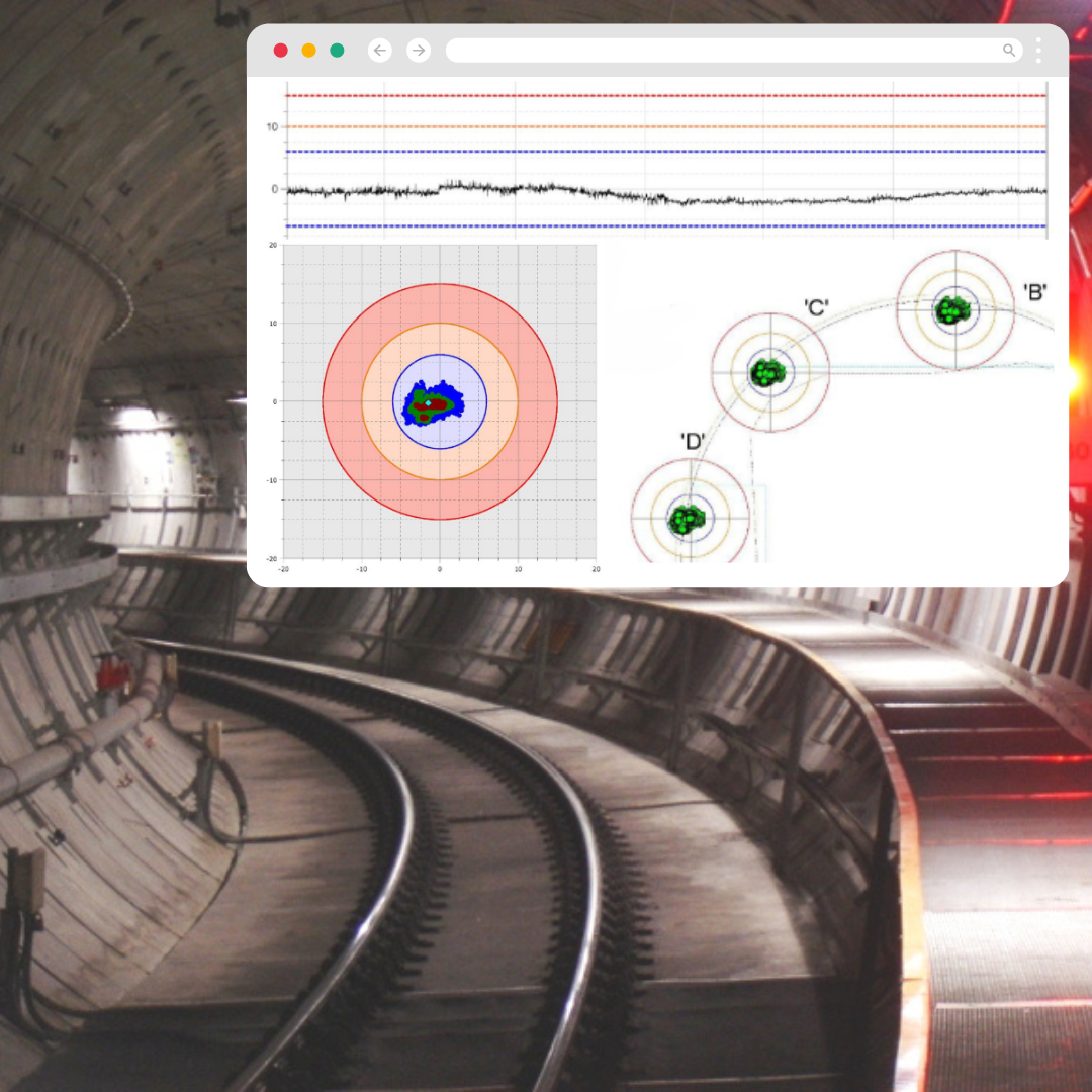
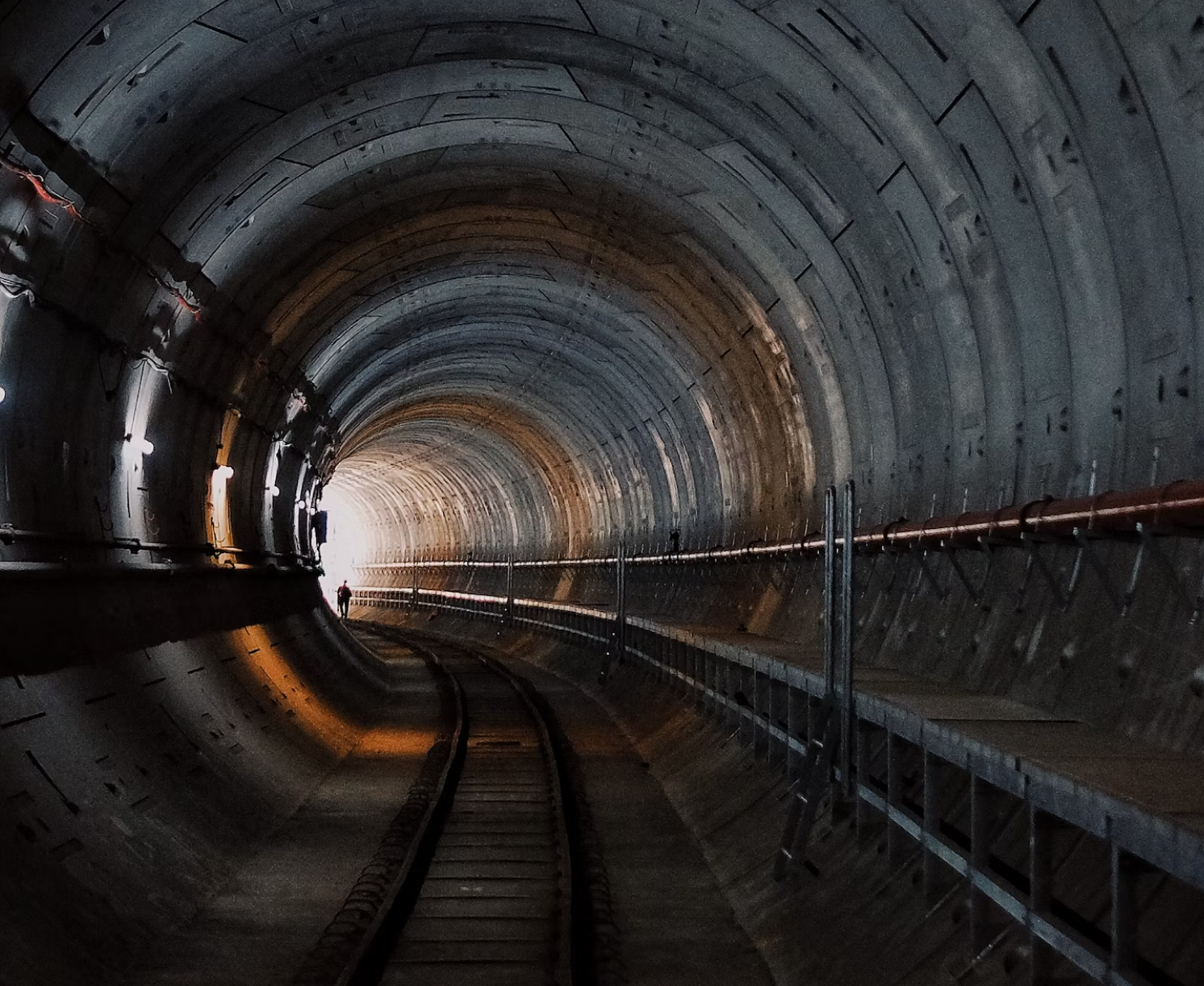
Australia | Perth's Passenger Railway Tunnels
GeoDin on critical railway tunnel construction surveillance
- 24-7 remote monitoring of twin concrete-lined tunnels
- 32k daily measurements with automated data collection and processing
- Measurements from all instruments and suppliers centralized in GeoDin
- Automated triggers for real-time environmental changes
- Series of data quality tests before written to the database
- Online portal to manage, analyze, and present data & reports
See what experts from Arcadis and Arup are saying